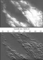
Image Estimation by Example: Geophysical Soundings Image Construction
by Jon Claerbout, Sergey Fomel
Publisher: Stanford University 2008
Number of pages: 330
Description:
This book is about the estimation and construction of geophysical images. Geophysical images are used to visualize petroleum and mineral resource prospects, subsurface water, contaminant transport (environmental pollution), archeology, lost treasure, even graves. People need more practice with easier problems like the ones found in this book, which are mostly simple 2-D landforms derived from 2-D data. Such concrete estimation problems are solved quickly, and their visual results provide experience in recognizing weaknesses, reformulating, and moving forward again.
Download or read it online for free here:
Download link
(9.5MB, PDF)
Similar books
 Geodesy and Gravity
by John Wahr - Samizdat Press
These are class notes for a geophysics course: observational techniques, physical geodesy, stress/strain relations, potential theory, interpretations of observed gravity anomalies, postglacial rebound, earth tides and earth rotation.
(15953 views)
 Tectonics: Recent Advances
by Evgenii Sharkov (ed.) - InTech
This book is devoted to different aspects of modern geodynamic processes. The text covers up-to-date materials of detailed geological-geophysical investigations, which can help understand the essence of mechanisms of different tectonic processes.
(9665 views)
 New Theory of the Earth
by Don L. Anderson - Cambridge University Press
Advanced textbook on the origin, composition, and evolution of the Earth's interior: geophysics, geochemistry, dynamics, convection, mineralogy, volcanism, energetics and thermal history. A reference for all researchers in the solid Earth sciences.
(26182 views)
 Geo-neutrinos and Earth's interior
by G. Fiorentini, M. Lissia, F. Mantovani - arXiv.org
Geo-neutrinos bring to the surface information from the whole planet, concerning its content of natural radioactive elements. Their detection shed light on the sources of the terrestrial heat flow, on the composition, and on the origins of the Earth.
(4381 views)